Mapping the Stars

Are you lost?
Look UP!
Our conventions for determining direction come from the sky. The rising and setting of the Sun gives us a (rough) east-west axis. The North Star, of course, gives us the north-south axis, as does the Moon (using the angle of its shadow).
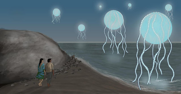
Knowing which way you are going is essential for any journey, but especially at sea where you have no landmarks to guide you. For this reason the earliest sailors used the stars to navigate across the ocean.
Knowing which way you are going is essential for any journey, but especially at sea where you have no landmarks to guide you. For this reason the earliest sailors used the stars to navigate across the ocean.
Naturally the stars are also used to navigate in space, where a third dimension is needed. We have a few systems for finding where you are on Earth or off it... but sci-fi writers rarely seem to make use of this...
How often do you see a movie or TV show in which the heroes boldly go to a planet, located ... somewhere in space. Maybe it doesn't bother you but I find it a little frustrating because I want to know where the planet is, orbiting which star (or stars), what type of star (or stars), how far is it from Earth, how far is it from that other planet you visited last week? How long does it take to get there from Earth? How long does it take to get there from the previous planet? Is it even in this galaxy???
Answering these questions will provide a nice three-dimensional picture of the arena in which the drama plays out, which is better than vague fudging.
That vagueness can itself be a handy plot device, of course... gloss over the specifics and you never have to concern yourself with such things as continuity or plausibility... but to me it smacks of indifference. It really does not take a lot of effort to research your setting and geeks love this kind of detail!
Many Tolkein-esque fantasy novels are prefaced by a map of the mythical land where the story will unfold, but sci-fi works rarely include star charts. Why???
Many Tolkein-esque fantasy novels are prefaced by a map of the mythical land where the story will unfold, but sci-fi works rarely include star charts. Why???

Star Trek scriptwriters are among the worst fudgers, especially in the original series, where there is no real sense of scope... Let's go right to the edge of the galaxy! Why not? With The Next Generation we at least get the system of dividing the Milky Way into Quadrants, with an acknowledgement that warp drive has a limit and you can't just go anywhere in an afternoon's travel time. Wormholes and additional exotic technologies are needed to visit Gamma or Delta, but not Beta, which is sort of nearer... we think ... maybe ... (It's the Fudge Quadrant).
The stars have shown us the way since ancient times; the earliest known navigators being Polynesian sailors who have been using Celestial navigation for 5000 years.
The most well known star used for astronavigation is of course Polaris (Alpha Ursae Minoris), the North Star. It is found very close to the North Celestial pole, a point projected onto the imaginary dome of the sky directly about the actual North Pole; the axis around which the Earth rotates and, therefore, a point that remains fixed on the sky.
Finding Polaris is fairly easy even for an amateur stargazer. If you can find the asterisk (star pattern) known as the Big Dipper, Polaris is a very bright star nearby. The last two stars making up the pan of the frying pan point towards it. Imagine the frying pan pivoting clockwise 90° and the tip of the handle will be pretty close to the North Star.
If you can see the Moon - and it is not full - there is an even easier method. Because the Sun always illuminates the Moon from exactly west or east, the shadow will always be at a perfect right angle to the north-south axis. Just extend that line down towards the horizon and, where it touches the horizon is south if you are in the northern hemisphere (and north if you are in the southern hemisphere).

The ancient Greeks invented the astrolabe, a device for measuring the angle/altitude of a star above the horizon, and the design was further developed by medieval Persian astronomers of the Islamic Golden Age. A sextant performs a similar function, and even astronauts have taken sextants with them on missions to the Moon as an emergency back-up in case they were unable to receive guidance from Mission Control.
Soon came whole systems of mapping the sky, starting with asterisms (patterns of stars formed by joining the dots and using a lot of imagination), constellations (segments of the sky containing said asterisms) and the zodiac (thanks to astrology, the callow youth who grew up and became astronomy), plotted along the ecliptic (the path apparently taken by the Sun, Moon and planets across the "fixed stars" of the sky).
With more advanced astronomy came the celestial sphere, an imaginary sphere projected onto the sky around the Earth, extending the Earth's equator and Poles outwards. Effectively, an inside-out globe, with lines corresponding to the equivalents of latitude and longitude: in the equatorial co-ordinate system (the one most often used by astronomers), a star's position is plotted using right ascension (west-east of the Sun at the Match equinox) and declination (north-south of the equator).
This gives us two dimensions for finding a star in the sky from our perspective down here on the surface of the Earth, but of course we need a third dimension to determine its true position; distance. The technique for measuring this, the stellar parallax, came in the 19th century. By noting the shift in position of a star from two different points at the Earth's orbit around the Sun (six months apart), its distance can be calculated using trigonometry.
The stars are so far away that their parallax is very small, so precision is vital. Today, of course, we use more reliable methods, mostly notably spectroscopy to measure redshift/blueshift (the compression/expansion of light waves from moving object, or Doppler Effect).

In 1908 the astronomer Henrietta Swan Leavitt discovered a method for determining distance by studying rapidly pulsating variable stars: Cepheid variables. Because they vary in brightness with a well-defined period and amplitude, they can be used to calculate the actual distance. Her discovery led to the correct distance measurement of the distance to the Magellanic Clouds (satellite galaxies of the Milky Way) and the confirmation that the Milky Way is just one galaxy among many in the universe.
Of course, all of our systems are essentially geocentric... almost as if we still believed that Earth was the centre of the universe! Sorry, Copernicus... Yes, we are spinning around a very average yellow star 27,000 light years from the centre of the Milky Way. Maybe we should use the centre of the galaxy as the frame of reference, as Starfleet does? We could use Sagittarius A* (the supermassive black hole)...
In recent years, with an increasing availability of information regarding astronomy and cosmology, sci-fi writers have started to embrace a little rigour and accuracy in their world-building when it comes to choosing planets. The planet Vulcan has been recognised as being in orbit of the triple system 40 Eridani (just under 17 light years from Earth; practically in Earth's back yard at warp speed).
So how does a good writer visualise space? Well, 3D maps do exist and they give a rough idea of the position of various stars in relation to each other. Software out there can model the galaxy and tell you how far apart different stars are from each other...
We have the technology. We have the knowledge. Fiction is better with a seasoning of fact. So please, give us our maps!

Comments
Post a Comment